


Introduction: A Strategic Shift in Geopolitical Technology Use
In a move that highlights increasing global divisions in the field of technology and military strategy, Iran has officially stopped using the American Global Positioning System (GPS) for its civil and military navigation. According to reports from Iranian state media, the Islamic Republic has now transitioned to China’s BeiDou Satellite Navigation System, making it the second country after Pakistan to fully integrate BeiDou into its national defense and civilian infrastructure.
This strategic shift marks a significant step in Iran’s pursuit of technological sovereignty and military secrecy, especially after recent hostilities with Israel exposed vulnerabilities in relying on American-controlled navigation systems. The Iranian government cited the need to protect sensitive military operations from foreign surveillance as a core reason behind the decision.
🌐 Understanding GPS and BeiDou: The Global Navigation Race
Before diving into the implications of Iran’s switch, it’s important to understand the systems involved:
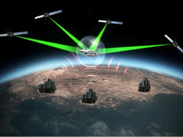
- GPS (Global Positioning System): Developed and controlled by the United States Department of Defense, GPS has long been the most widely used satellite navigation system in the world. It offers geolocation and time data to GPS receivers anywhere on or near the Earth.
- BeiDou Navigation Satellite System (BDS): Developed by China, BeiDou is a global satellite navigation system that became operational globally in 2020. It offers services similar to GPS but is fully independent of US control.
With increasing tensions between global powers, alternative systems like Russia’s GLONASS, the EU’s Galileo, and China’s BeiDou have gained importance among nations seeking autonomy in navigation technology.
📡 Why Iran Abandoned GPS: A Matter of National Security
Iran’s decision is rooted in security concerns, particularly regarding the vulnerability of relying on an American-owned system for sensitive operations. Recent conflicts, including the 12-day war between Israel and Iran, saw Israeli agents using GPS to guide drone strikes on Iranian military installations.
Such incidents have exposed a critical flaw: since GPS is operated by the US military, it is susceptible to manipulation, interception, or surveillance. Iranian defense officials argue that using GPS for mission planning and drone guidance compromises operational security, especially when dealing with adversaries closely aligned with the United States, like Israel.
By switching to BeiDou, Iran believes it can shield its military infrastructure and movements from external interference and ensure confidentiality in planning and execution of operations.
🛰️ The Role of BeiDou in Iran’s Military Strategy
BeiDou offers several strategic advantages for Iran:
- Encrypted Military Signals: BeiDou provides military-grade positioning data through encrypted channels, making it far more secure for combat and reconnaissance missions.
- Two-Way Communication Capability: Unlike GPS, BeiDou offers a unique two-way communication service, allowing users not only to receive signals but also to transmit short messages — a feature highly valuable for military use in areas with poor connectivity.
- Greater Precision: BeiDou reportedly offers high-precision navigation within 10 centimeters in certain applications, providing better support for precision-guided weaponry, surveillance drones, and naval maneuvers.
- Autonomous Operation: By relying on BeiDou, Iran removes the risk of losing navigation access in the event of US sanctions or GPS denial, which the US can legally enforce in times of conflict or political escalation.
🇨🇳 China’s Role: Strengthening the Tech-Military Alliance
Iran’s shift toward BeiDou is more than a technical change; it reflects the deepening military-technical relationship between China and Iran. China has invested heavily in expanding its Belt and Road Initiative (BRI) and establishing geo-strategic partnerships in the Middle East.
By sharing BeiDou’s full capabilities with Iran — including military-grade encryption — China signals its growing influence in global defense alliances. This move may also reflect broader ambitions to challenge US technological dominance, especially in regions where America’s strategic position is being contested.
🤝 Pakistan’s Precedent: The First Adopter of BeiDou for Defense
Interestingly, Pakistan was the first country to fully adopt BeiDou for military use, setting a precedent for other non-Western military alliances. As a long-standing strategic ally of China, Pakistan’s armed forces have benefited from precision navigation in missile systems, air force operations, and ground troop coordination using BeiDou.
Iran appears to be following a similar path, especially after growing cooperation with Pakistan on border security, energy trade, and joint defense strategies. Both countries now stand as regional BeiDou users, giving China significant influence over two key players in the Muslim world.
🔐 Protecting Military Secrets: Strategic Autonomy Over Transparency
One of the primary motivations behind Iran’s adoption of BeiDou is the desire to protect military secrecy and avoid data leakage to adversaries. Military experts suggest that the use of GPS opens a backdoor for foreign intelligence agencies to:
- Track troop movements
- Monitor missile or drone flight paths
- Intercept encrypted communications
By cutting GPS dependence, Iran is also preparing itself for a future of electronic warfare, where data integrity and secure geolocation will be just as important as traditional weaponry.
🌍 Broader Implications: A Fragmented Navigation Future?
Iran’s departure from GPS is part of a wider global trend where countries are building or adopting independent navigation systems to reduce reliance on Western technology. This could lead to a technologically fragmented world, where:
- Allied countries use shared systems (e.g., NATO members rely on GPS)
- Rival blocs adopt alternative systems (e.g., China’s BeiDou for SCO or BRICS nations)
- Multi-system integration becomes standard in commercial technology to prevent geopolitical restrictions
For instance, smartphones and drones sold globally now often support GPS, BeiDou, GLONASS, and Galileo — a hedge against dependency on a single system.
⚖️ Risks and Challenges for Iran
While BeiDou adoption gives Iran more control over its navigational infrastructure, there are challenges:
- Overdependence on China: Some analysts argue that replacing one dependency with another could create future leverage for Beijing over Tehran’s defense and economic decisions.
- Technical Integration: Shifting an entire military and civil infrastructure from GPS to BeiDou requires massive upgrades in hardware, software, and training.
- Diplomatic Consequences: Iran’s closer alignment with China could further alienate it from Western diplomatic and technological cooperation.
📰 Conclusion: A New Era of Strategic Independence
Iran’s decision to abandon the US-operated GPS system and switch to China’s BeiDou marks a pivotal moment in the geopolitics of technology. With rising concerns over surveillance, data leaks, and foreign interference, countries like Iran are seeking self-reliance in critical defense infrastructure.
This move, driven by recent military conflicts and a rapidly polarizing global order, showcases how satellite navigation is no longer just a civilian convenience — it has become a battlefield necessity and a strategic asset in modern warfare.
As Iran integrates BeiDou into its military command, navigation, and communication systems, it may set a powerful precedent for other nations aiming to decouple from Western tech dependence while maintaining operational sovereignty.


